Project Details
Project
Madera-Chowchilla Groundwater-Surface Water Simulation Model (MCSim)
Client
Madera County, Madera and Chowchilla Subbasin GSAs
Location
Eastern San Joaquin Valley
Simulating the projects and management actions needed to achieve sustainable groundwater management
We developed MCSim, an integrated groundwater-surface water model for the Madera and Chowchilla Subbasins, to support sustainability analyses and the development of two Groundwater Sustainability Plans (GSPs).
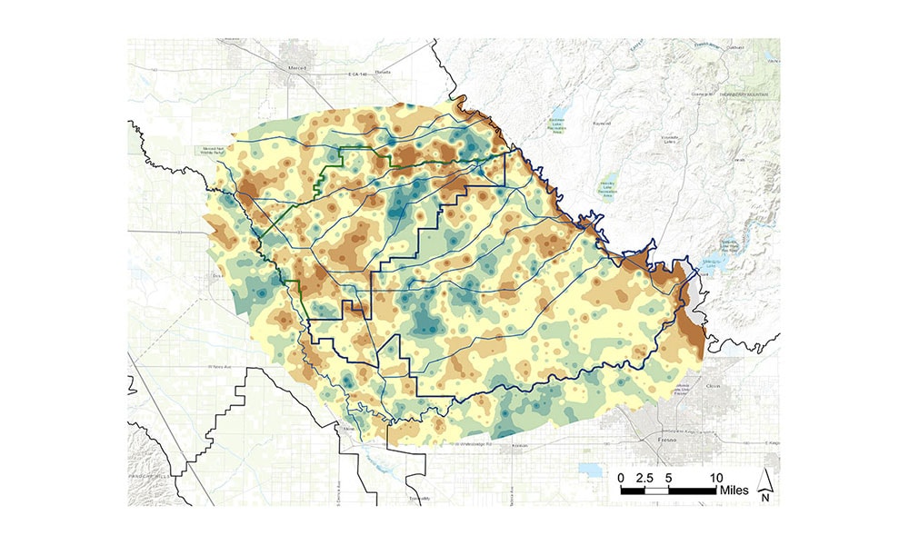
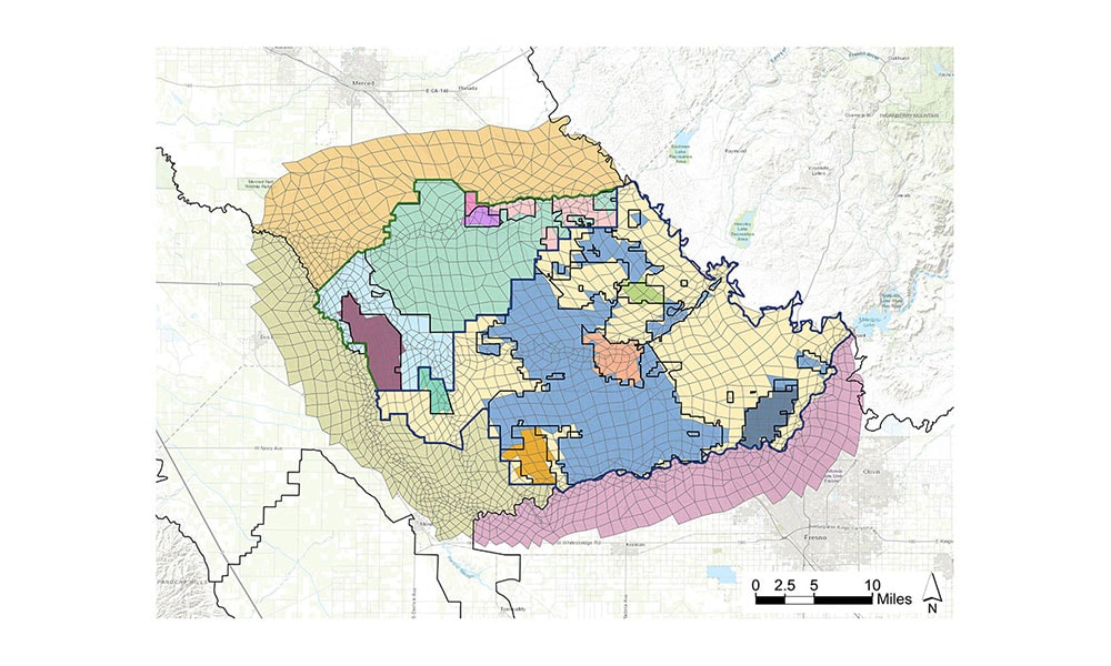
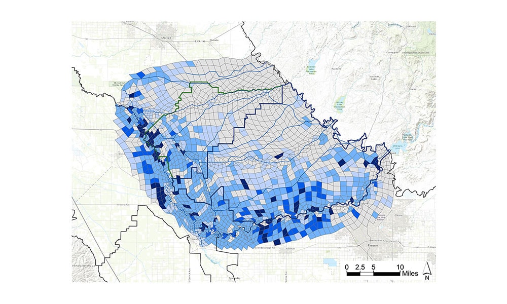
The model is built on the IWFM platform and was developed through substantial reconceptualization and refinement of DWR’s C2VSim-FG model. Model development involved refining the existing and uncalibrated beta version of C2VSim-FG to represent the Hydrogeologic Conceptual Model (HCM) outlined for the region as part of the GSP development process. This included additional lateral and vertical model discretization, analysis and integration of borehole lithologic data into a 3D geostatistical model using TProGS, and representation of local water supply distribution system operations and surface activities.
MCSim was calibrated over a 27-year historical period and used to simulate groundwater and surface water conditions under future scenarios of projects, management actions, climate, and other hydrologic constraints through 2090 to evaluate groundwater sustainability.
The model was successful in providing the technical basis for evaluating projected conditions with respect to groundwater sustainability and sustainability indicators (e.g., groundwater levels, stream depletion, change in storage, and land subsidence) and for demonstrating the future sustainability of the subbasins under projects and management actions proposed in the GSPs.

Significant Project Elements
- Simulation of water supply and distribution system for multiple entities within and adjacent to the subbasins
- Performed geostatistical modeling using subsurface lithologic texture data from more than 1,100 well boreholes
- Integrated modeling of groundwater and surface water system to simulate surface water supply and groundwater pumping demand
- Incorporation of flood bypass operations
- Project and management action scenario development including for recharge ponds, flood water managed aquifer recharge (Flood-MAR), and vertical redistribution of pumping to mitigate aquifer-specific overdraft and resulting land subsidence impacts
- Historical, current, and future water budget development
- Evaluation of future conditions under climate change scenarios
Project Details
Project
Madera-Chowchilla Groundwater-Surface Water Simulation Model (MCSim)
Client
Madera County, Madera and Chowchilla Subbasin GSAs
Location